42km
4 days, 3 nights
New South Wales
September 2025
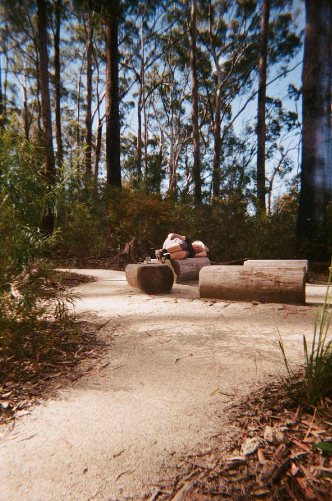
Gidjuum Gulganyi is a 42km hike through the ancient gondwana rainforest and epic volcanic remains of the Tweed and Byron hinterland on Bundjalung Nation. Over four days, this trek traverses lush subterranean rainforest and thick eucalypt bush through Mount Jerusalem National Park, Whian Whian State Conservation area and Nightcap National Park. This adventure will draw on your skills for trekking through bush, rock-hopping across rivers and climbing long ascents all for the reward of spectacular views and unique perspective along the rim of the Tweed caldera, Wanganui Valley, and finally, Minyon Falls.
Long before the official walk existed, the Widjabul Wia-bal and Minjungbal people of the Bundjalung Nation walked these lands for millennia, caring for the land and finding life, prosperity and meaning in the natural landscape. In traditional language Gidjuum Gulganyi means ‘Old people’s track’ (NSW Government, 2025), and it’s worth a moment to reflect on the generations of wisdom, culture and connection that has been passed down here. I’d like to pay my respects and give thanks for the opportunity to share in this little piece of wonder.
This is a Grade 4 walk and requires some experience and relative fitness, with day two being particularly challenging with steep sections and long ascents. Recently opened, Gidjuum Gulganyi offers a new and exciting adventure in the northern end of NSW, easily accessible from Brisbane, Gold Coast and the mid-north coast of NSW. Official track information can be found here.
What’s Ahead:
- Getting to & from the Trail
- Planned Route
- Navigation & Safety
- Conditions & Terrain
- Campsites
- Packing List
- Day 1: Manns Rd Trackhead to Sand Ridge Campground
- Day 2: Sand Ridge Campground to Yelgun Kyoomgun Campground
- Day 3: Yelgun Kyoomgun Campground to Weeun Weeun Campground
- Day 4: Weeun Weeun Campground to Minyon Falls
- Reflections: Peaks & Pits
Getting to & from the Trail:
CAR DROP:
The NSW National Parks and Wildlife Service strongly recommends against leaving cars at the trailhead, and they mention that the track can become unsurpassable after bad weather. While we had no issues when we left our cars, only a couple of weeks later we saw some posts on Facebook (look up Gidjuum Gulganyi Walk [Tweed Byron Hinterland Multi-Day Hike] page for updates from hikers who have recently completed the trail) that multiple cars had been damaged and broken into. So leave your car at your own risk.
Despite the advice, we opted to do a car drop as we had one party travelling from mid-coast of NSW, and one party travelling from Brisbane. We met at Minyon Falls where we left one car and transferred bags all into the other (leaving some nice clean clothes to change into once we finished). We then drove to Manns Road Trackhead where we left the second car. The car drop is a bit of a time commitment, but we were able to start walking by 10:30am which was a similar start time to those who took the shuttle bus.
TRANSFER:
There is the option to pay for a transfer to/from the trailhead from multiple locations. This is available through Vision Walks Eco Tours and prices start at $66.
Planned Route
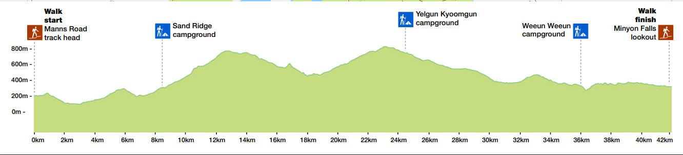
Gidjuum Gulganyi has established campgrounds for each night of the walk. This means there are set distances each day so you will need to complete the below route as a minimum, and you can’t stay at a campsite for more than one night. This means you can make the walk shorter by squeezing a couple of days together, but you can’t really lengthen the walk by an extra day.
There is a walkers camp at Rummery Park but this is very close to Minyon Falls so doesn’t make much sense as a campsite if you’re completing the trail.
If you’re tight on time, the last two days can easily be combined, with the last day being particularly easy going as it’s mostly downhill or flat.
| Journey | Distance | |
| Day 1 | Manns Road Trackhead to Sand Ridge Campground | 8.5km |
| Day 2 | Sand Ridge Campground to Yelgun Kyoomgun Campground | 16km |
| Day 3 | Yelgun Kyoomgun Campground to Weeun Weeun Campground | 11.5km |
| Day 4 | Weeun Weeun Campground to Minyon Falls | 6km |
Navigation & Safety:
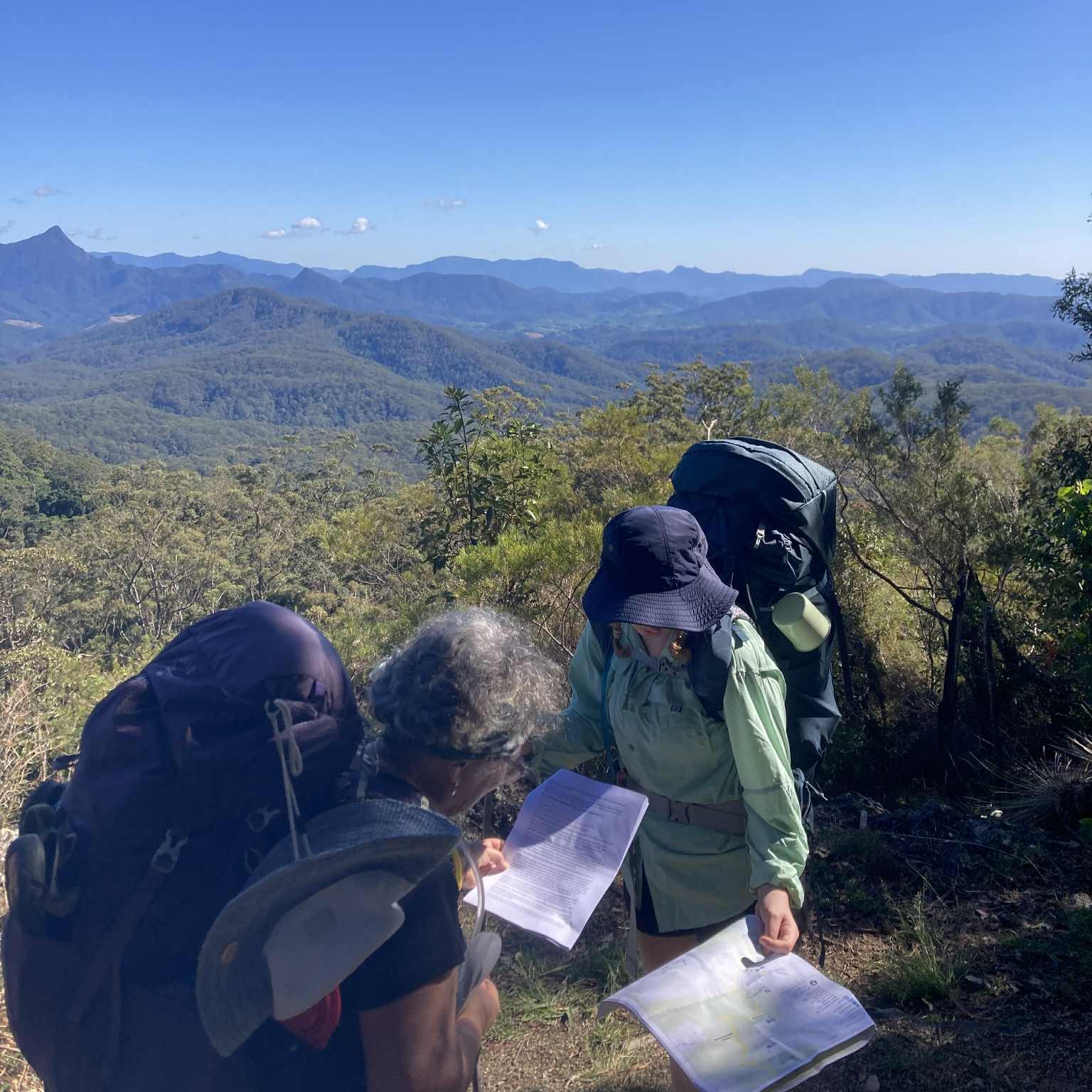
This track is one-way only, so everyone will be walking north to south. You can get a copy of the map either on the NSW National Parks app, or you can find a copy to print here. The track is well-signed with regular markers to keep you on track and few turnoff opportunities so you can’t go too far wrong.
Don’t forget to complete a Trip Intention Form and update your emergency contacts of your planned route and walking days. There is intermittent phone signal available on this walk, but it’s still recommended to take a Personal Locator Beacon (PLB). If you don’t have one, you can usually rent one from your local outdoors store at a pretty reasonable price.
It’s also good to download the Emergency Plus app which will help you to give an exact location if you ever have to call for help. Make sure you also take a first aid kit with the essentials.
Lastly, check the park alerts on the National Parks and Wildlife Service website and be aware of the evacuation points along the walk. There are several fire trails and evacuation points that you will directly pass on the trail.
Conditions & Terrain:
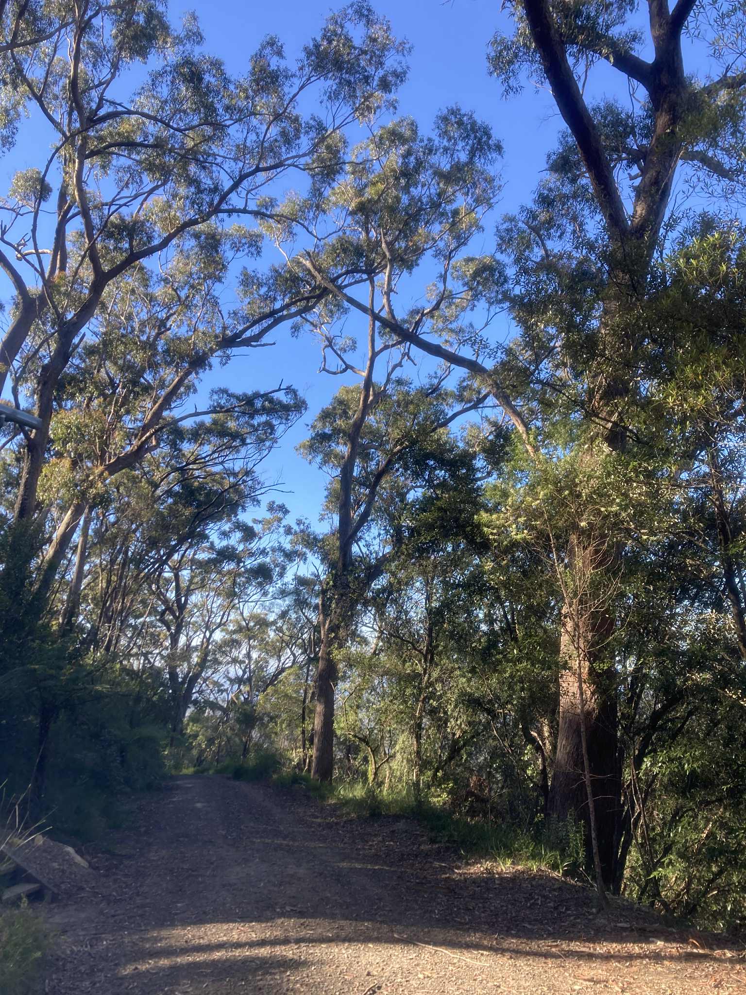
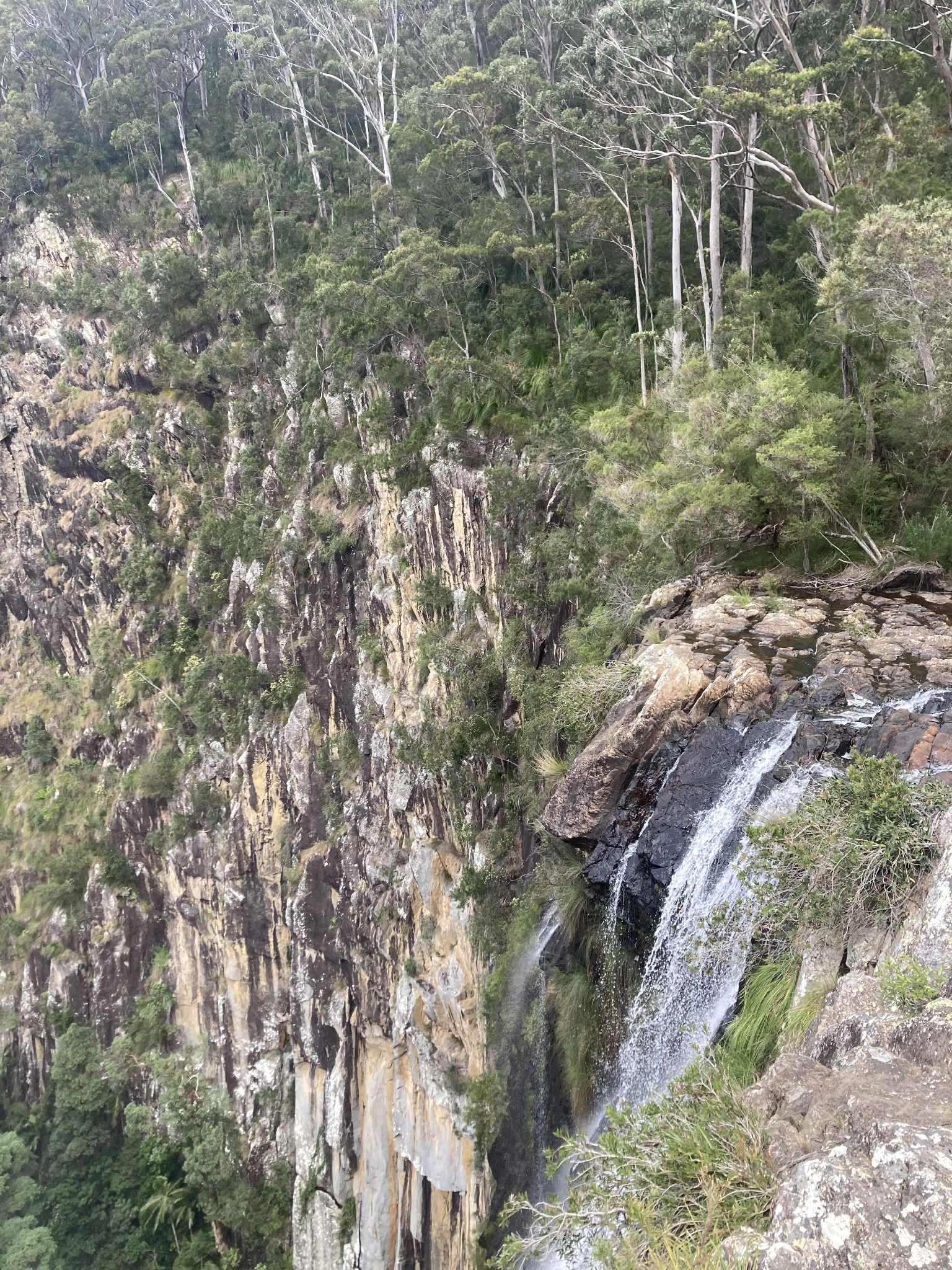
The trail is in very good condition, with a fairly worn trail and clear markers. There were a couple of moments where we wondered if we had somehow gotten off track, but it wasn’t far before we found another arrow. The trail is mainly through bushland, so is solid ground but of course, uneven in sections. If you refer to the elevation profile on the map you will see that there are lots of uphill sections, particularly on day 2. Sections of day 2 are very steep, and the trail involves zigzagging track and long sections of stone steps.
(Image retrieved from: https://www.nationalparks.nsw.gov.au/-/media/visitor/files/pdf/maps/1-mip-bespoke-pdf-maps/gidjuum-gulganyi-walk-map_a3.pdf)
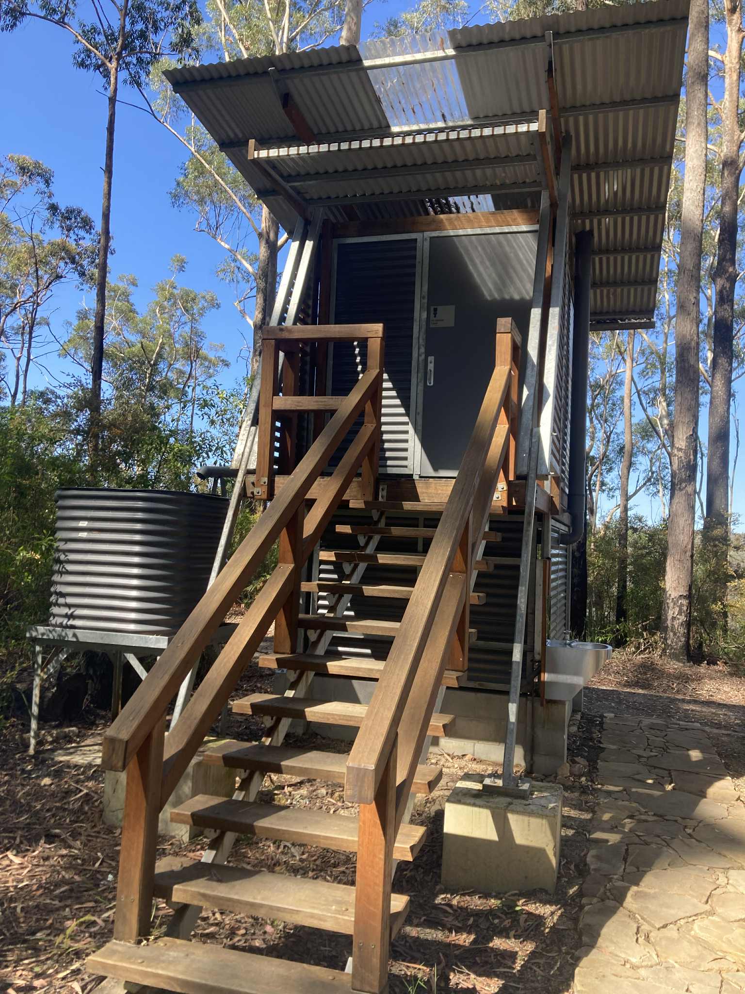
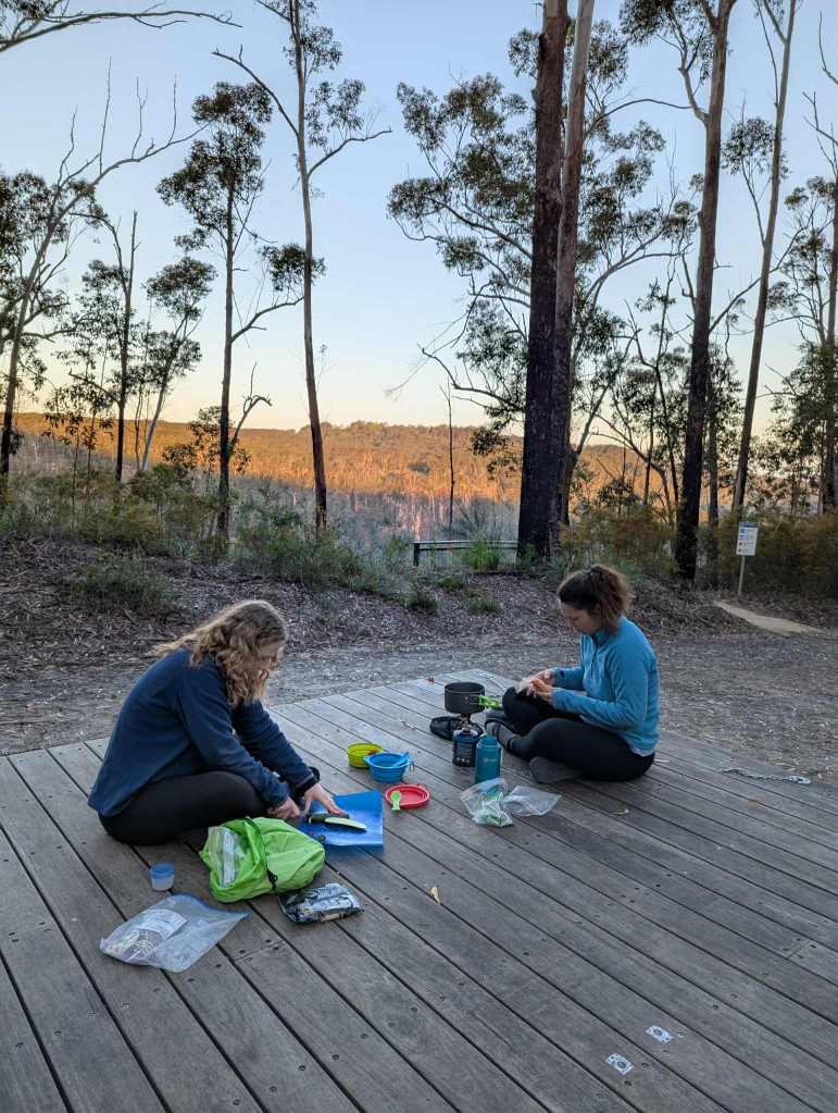
Campsites:
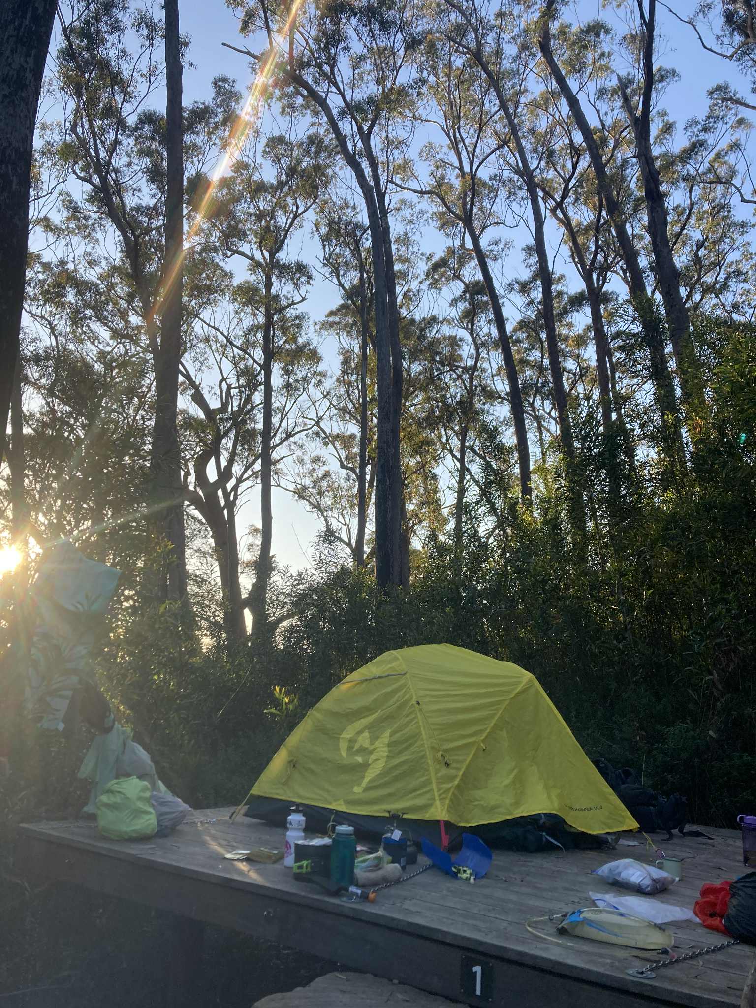
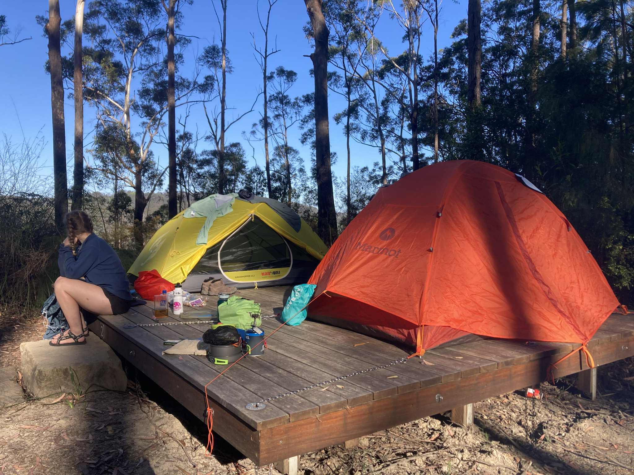
It costs $173 per campsite for all three nights. You can generally fit two people per campsite, so it’s pretty reasonably priced ($87/each for the whole trip including campsites and there is no additional permit to access the national park). According to the website, campsite platforms are 4.8 x 3.6m. The platform easily fit our two small tents (2-person tents), and there was even some spare room for cooking. Bookings can be made here.
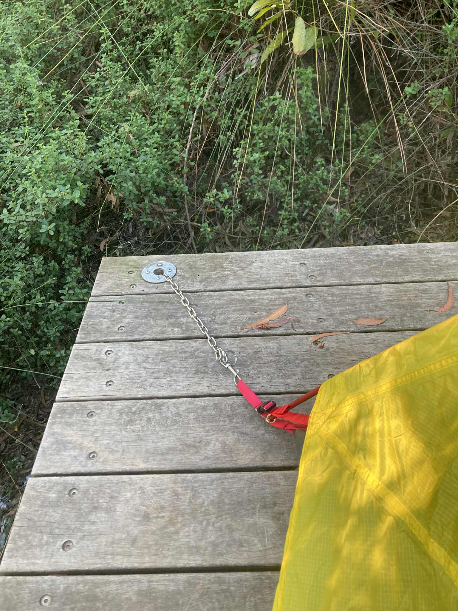
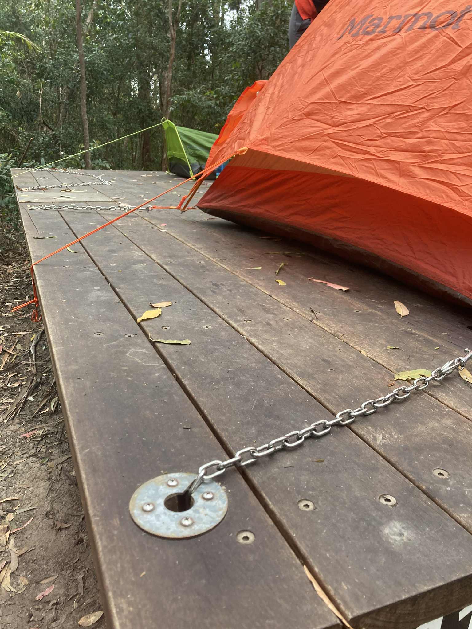
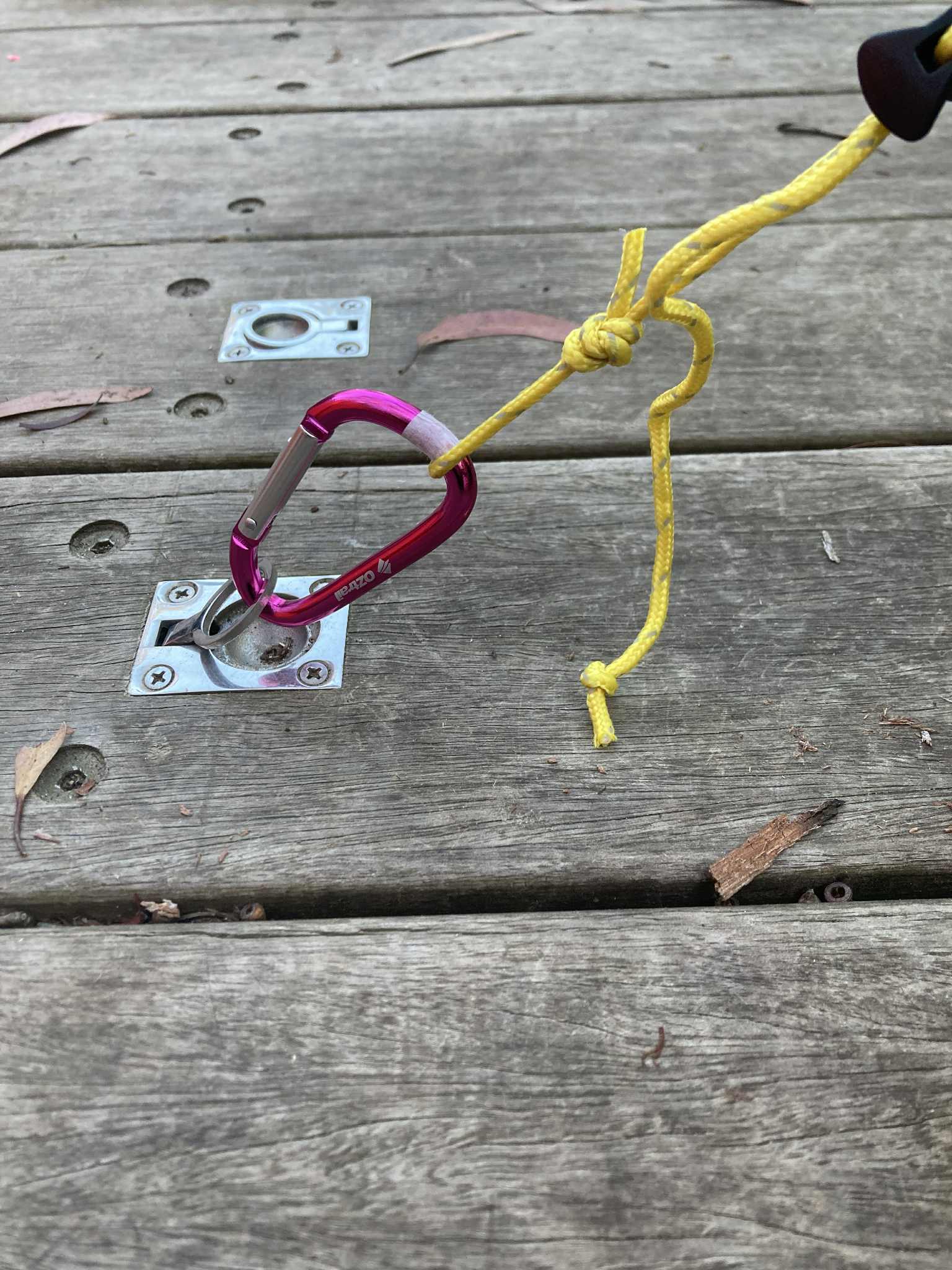
There are chains set-up around the platform to help secure the tent onto the platform. The good news is that you don’t have to take any pegs, and there’s some luxury in being off the ground. I would suggest taking a small amount of rope or guy ropes and a carabiner to secure the tent. It was very easy to set-up and the photos will hopefully give some more insight into how you can make the set-up work for your tent. The campsites are typically split up into two sections, 1) for sites 1-7, and 2) for sites 8 – 11. So if you’re booking with friends, just be aware you may end up a bit of a walk from one another.
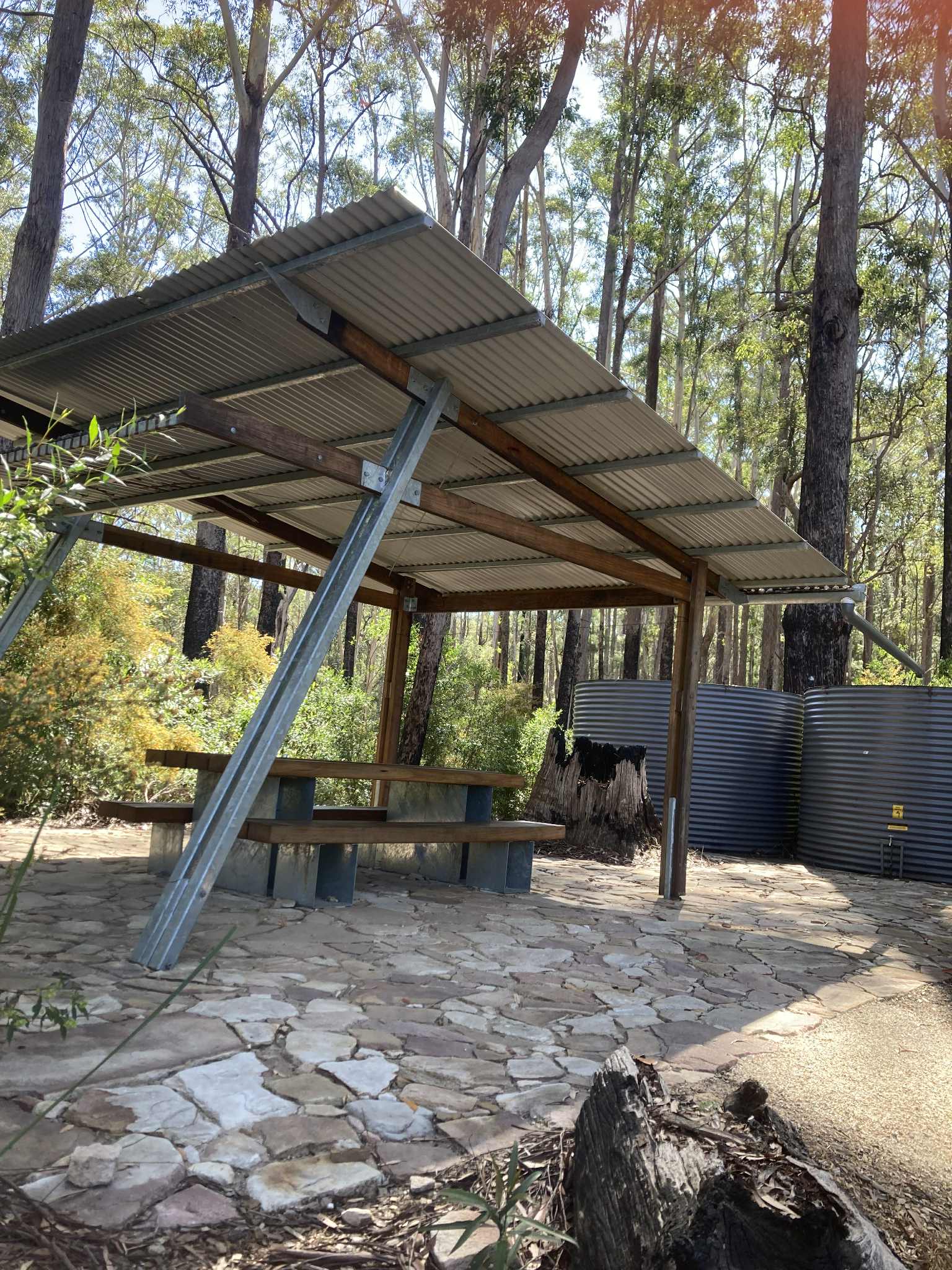
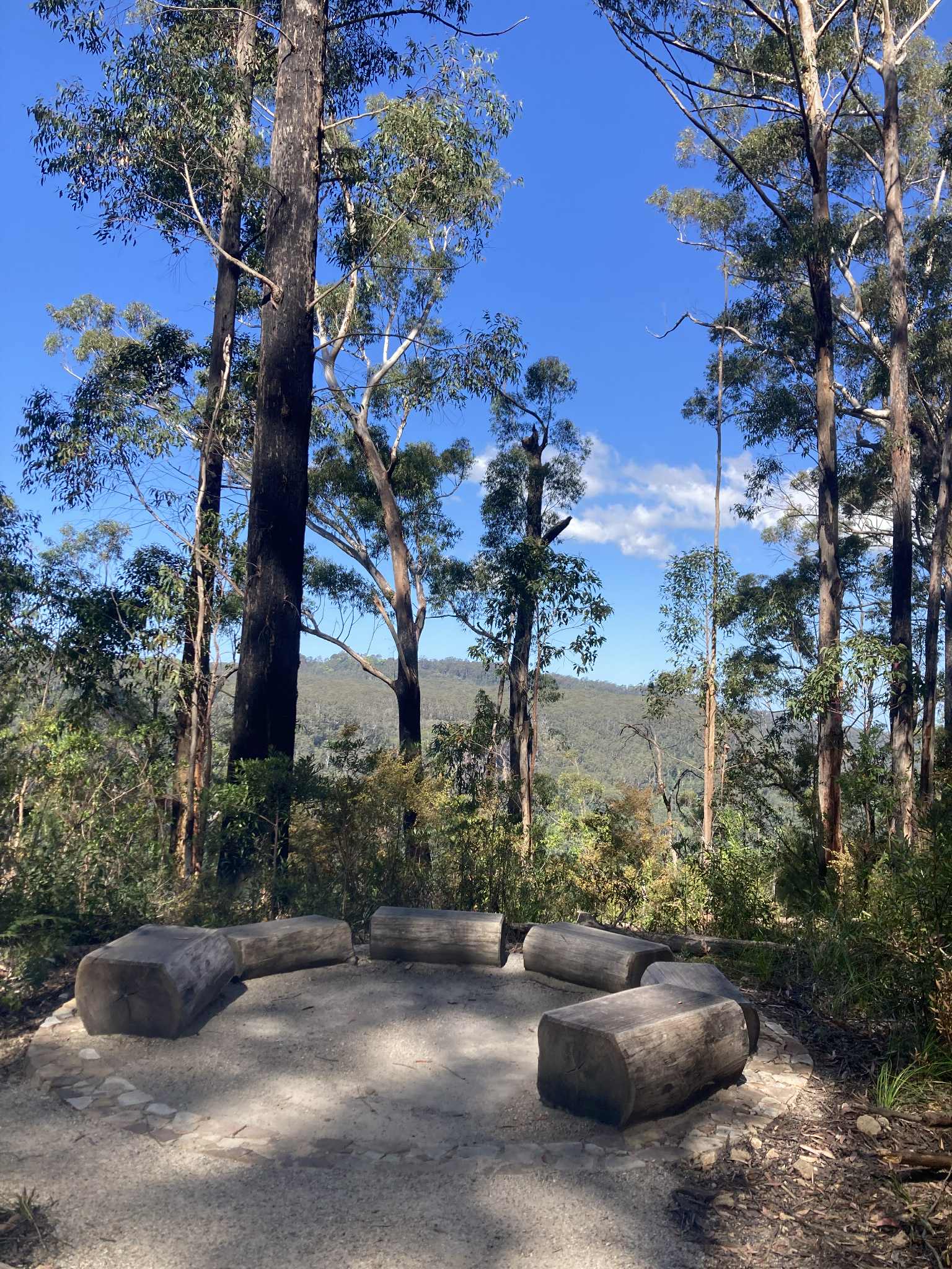
There is one composting toilet at each site, and 2 shared shelters with seating areas and water tanks. The toilets were fairly well maintained when we visited, but one toilet for 11 campsites (potential of up to 22 people) meant that access to the toilet was pretty competitive. There are also yarning circles as a space to gather and connect, or take a nap in the sun. The water had some discolouration but was absolutely fine and we treated it either by boiling or using water purification tablets.
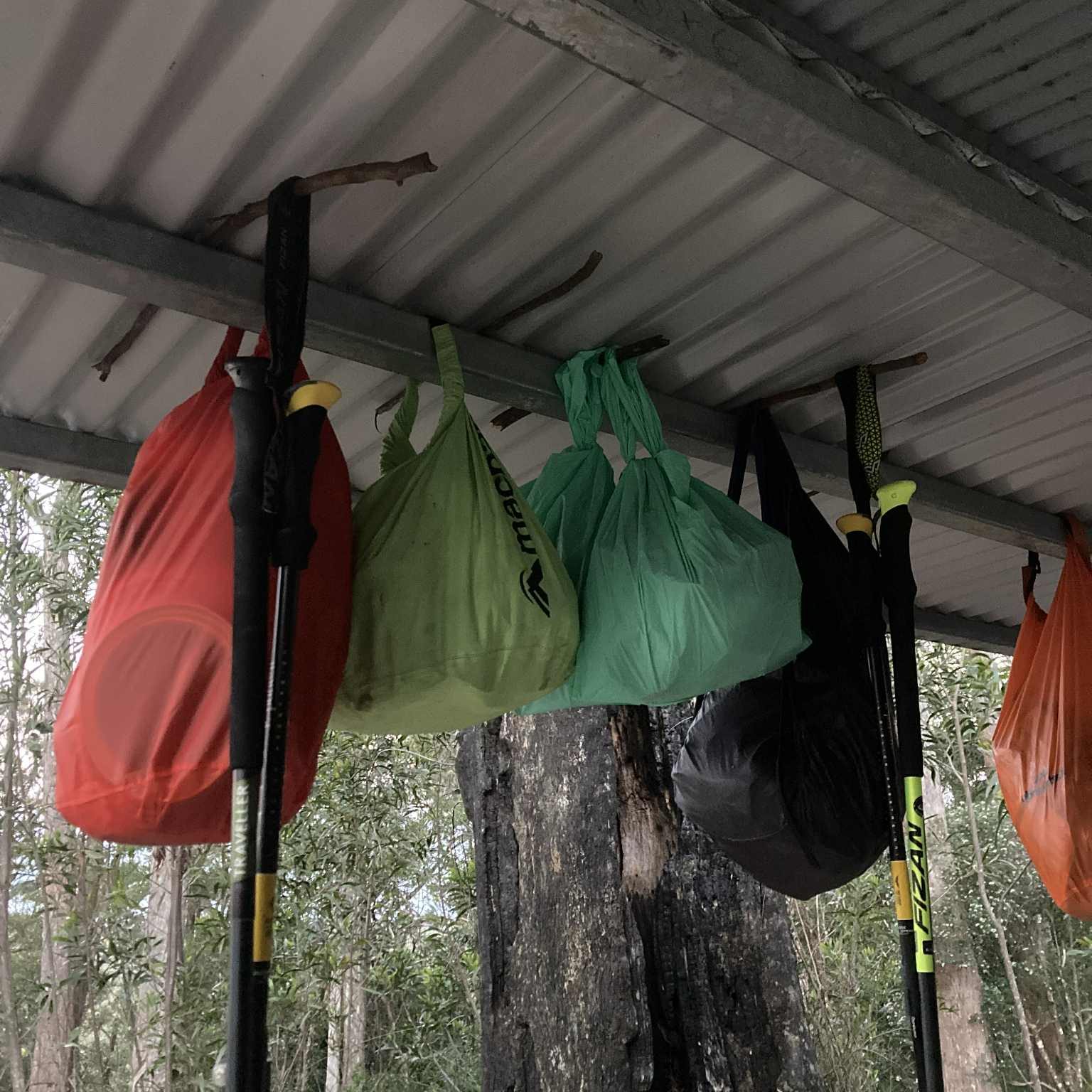
The biggest challenge at the campsites were bush rats. Before starting the walk we had heard there were some issues with rats getting into food at the campsites. On our trip, 3 groups fell victim to the rats either eating through their tent or their hiking packs to get to food, including one woman waking to the rats still inside their tent! You could also hear the bush rats being very active and inquisitive at night, so there are definitely a few of them around.
Our group opted to seal all food in multiple layers of ziplock bags and use ‘smell proof’ bags (something like this) to try and minimise the smell of the food. Any open food was placed in a ziplock bag and then either placed in another larger ziplock/freezer bag, or placed in one of the smell proof bags.
We used two different strategies overnight:
- After making sure all food was sealed and smells reduced, we then put all the food into a dry bag, and we slept with these in the tent overnight. After making sure that all food, snacks and rubbish were out of the pack, we left our packs outside and unzipped overnight in the hopes that a rat would explore and realise no food was inside rather than chewing through the bag to learn this.
- Again after sealing the food into multiple ziplock bags, we placed all food into one dry bag and hung it from the shelter. The shelter has a small section with a metal bar directly under the corrugated iron roof. This meant the bags could be hung and it would be very awkward for either rats or possums to be able to access the bags. We were able to just use the dry bag buckle to secure the bag, but others threaded sticks under the metal bar, and then hung the bags from the sticks. There were no issues for any camps who hung their food.
Packing List:
We did the walk in September and the season was already fairly warm. We didn’t take a puffer jacket and just had thermals and a fleece overnight which worked well. It did get quite cold overnight, so I would suggest a good sleeping bag.
See our packing list below. Of note, I took my usual hiking pack which is 60L. Something around the 40-50L mark would work, but we just went with the gear we already had.
| GEAR: Hiking pack (50-60L) Dry bags Water bladder/drink bottles (at least 2L) Waterproof pack cover Sleeping bag Sleeping mat Sleeping bag liner Tent Headtorch + batteries Electrical tape Trowel Map Compass Ropes/guy cords/carabiner | FIRST AID & SAFETY: Personal Location Beacon (PLB) Bug repellent Snake bite bandage Bandaids Blister kits Hand sanitiser Pain killers/Analgesia Antihistamine Sports tape Tweezers Scissors Antiseptic cream Alcohol wipes Tick remover |
| COOKING: Tea towel Washing up liquid and sponge Gas stove and cookwear Gas/butane canister Matches/lighter Cup/mug Spork Plate/bowl Sharp knife Chopping board Garbage bag | CLOTHING: Hiking shirt Hiking pants/shorts Thermal top and bottom T shirt for camp Pants for camp Fleece Rain jacket/poncho 2x sports bra 2x hiking socks 1x camp socks Hiking boots/trail runners Camp shoes (crocs/sandals) Hat Sunnies |
| TOILETRIES: Toothbrush Toothpaste Hairbrush Sunscreen Hand sanitiser Toilet paper Vasoline (as lip balm and to help with chaffing) | OPTIONAL: Tarp/ropes Walking poles Book Camera Binoculars TowelPillow Power bank Face wash and moisturiser |
Day 1: Manns Rd Trackhead to Sand Ridge Campground
Distance: 8.5km
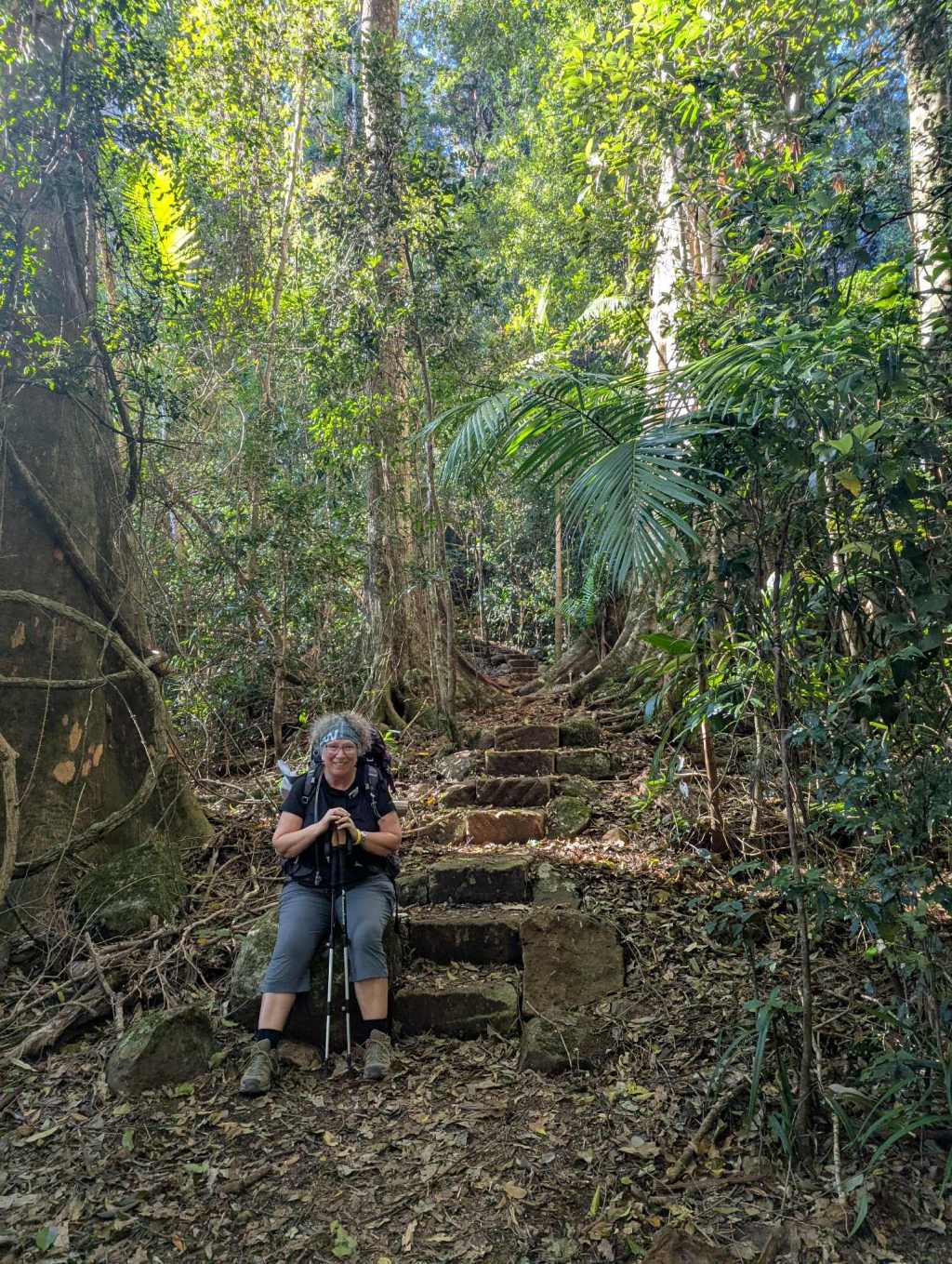
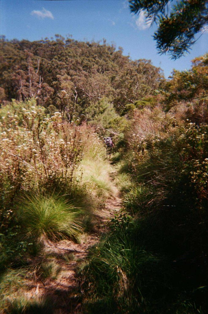
Day 1 started with excitement as we met our comrades at Minyon Falls, dropped off one car, and then headed to Manns Rd trailhead for the start of the walk. There is apparently a short loop at the start of the walk to Unicorn Falls, but we opted to walk directly to camp. It was about 10:30am by the time we arrived at the trailhead and started walking. The first day starts with walking alongside the access road, before gradually transitioning into rainforest. There are 7 creek crossings (water was low when we went, so we could easily rock hop around), and we were cheered along by the gentle song of the creek.
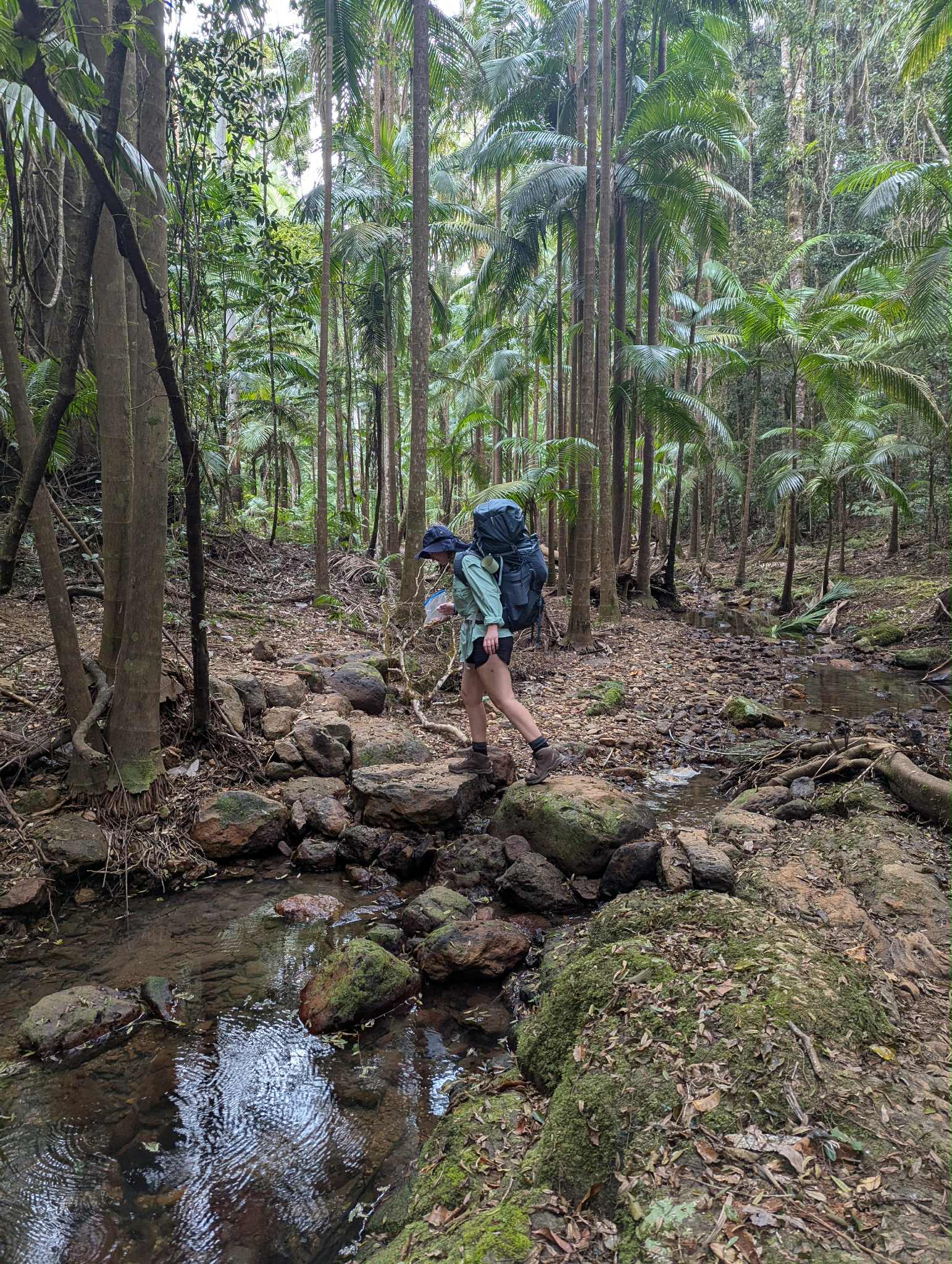
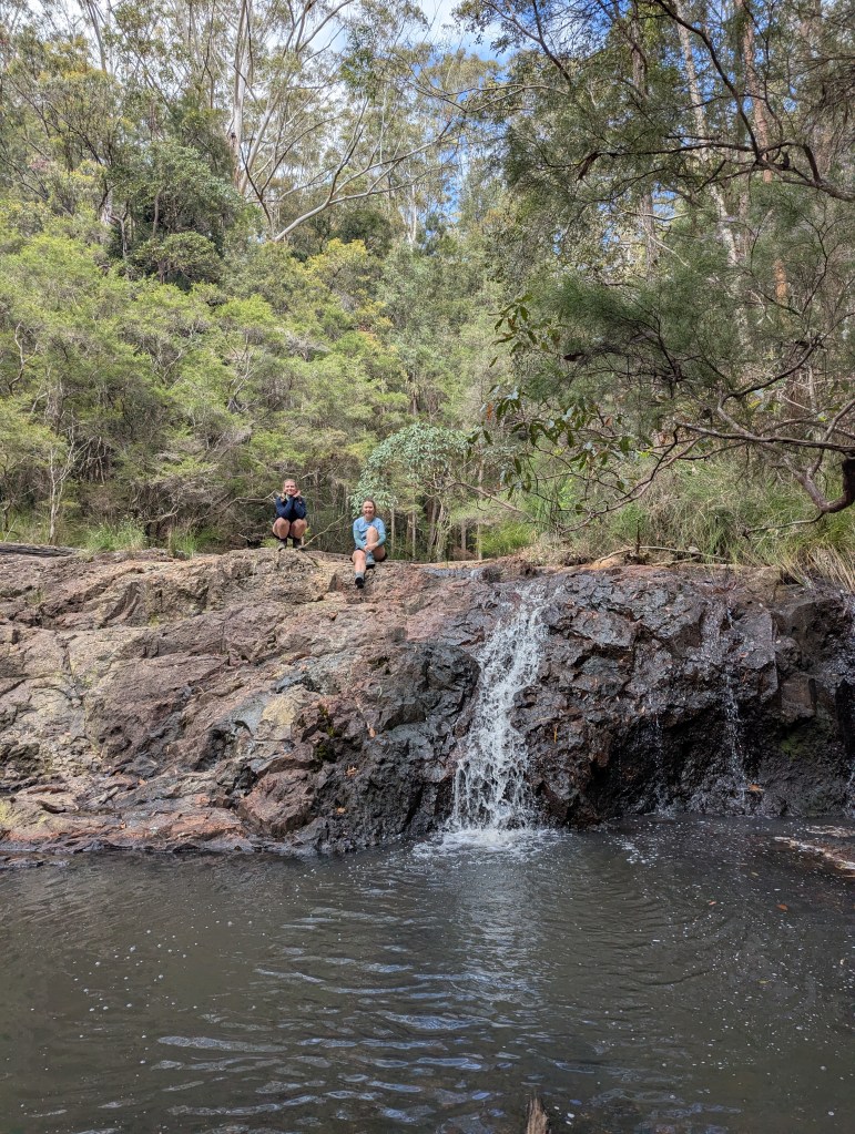
There were some uphill sections, including short steep sections, but overall the first day is a relaxing start. Only a few kilometers before camp you will pass Hell Hole Falls which is a beautiful spot to stop. From the water hole you can look over the green canopy below and into the distance. We had a quick swim and enjoyed the serenity as we had the spot to ourselves. We then took on the final climb up to Sand Ridge campground where we made camp. We planned for day 2 while eating our Japanese curry, and headed off to an early bed.
Sand Ridge Campground:
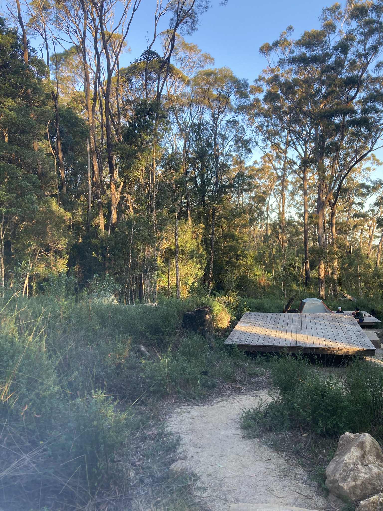
Sand Ridge campground is well-covered under canopy of New England blackbutt eucalypt. The campsites are laid out in a circle and are quite close to eachother. The layout makes this a less private campsite than what I have seen on most other great walks, but the facilities were great and the set-up fostered some more opportunity for connection with fellow hikers.
Peaks & Pits:
PEAK: Swim at Hell Hole Falls.
PIT: Steep sections and zigzagging.
Day 2: Sand Ridge Campground to Yelgun Kyoomgun Campground
Distance: 16km
We woke up early, having a quick breakfast and racing to leave camp before the sun was truly up. There were some nerves in the group knowing it was the longest and most difficult day ahead, and the weather was already hot! We made sure to carry as much water as we could, and I would recommend at least 3L, but more if you have the space and are easily affected by the heat. Several of the walkers that day almost ran out of water and there are no options to fill-up during the day.

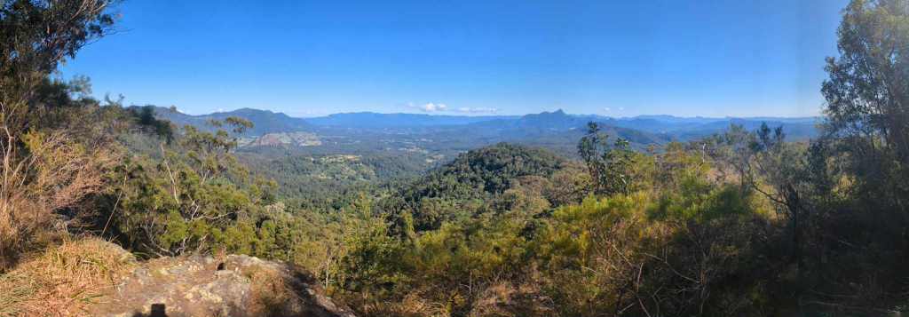
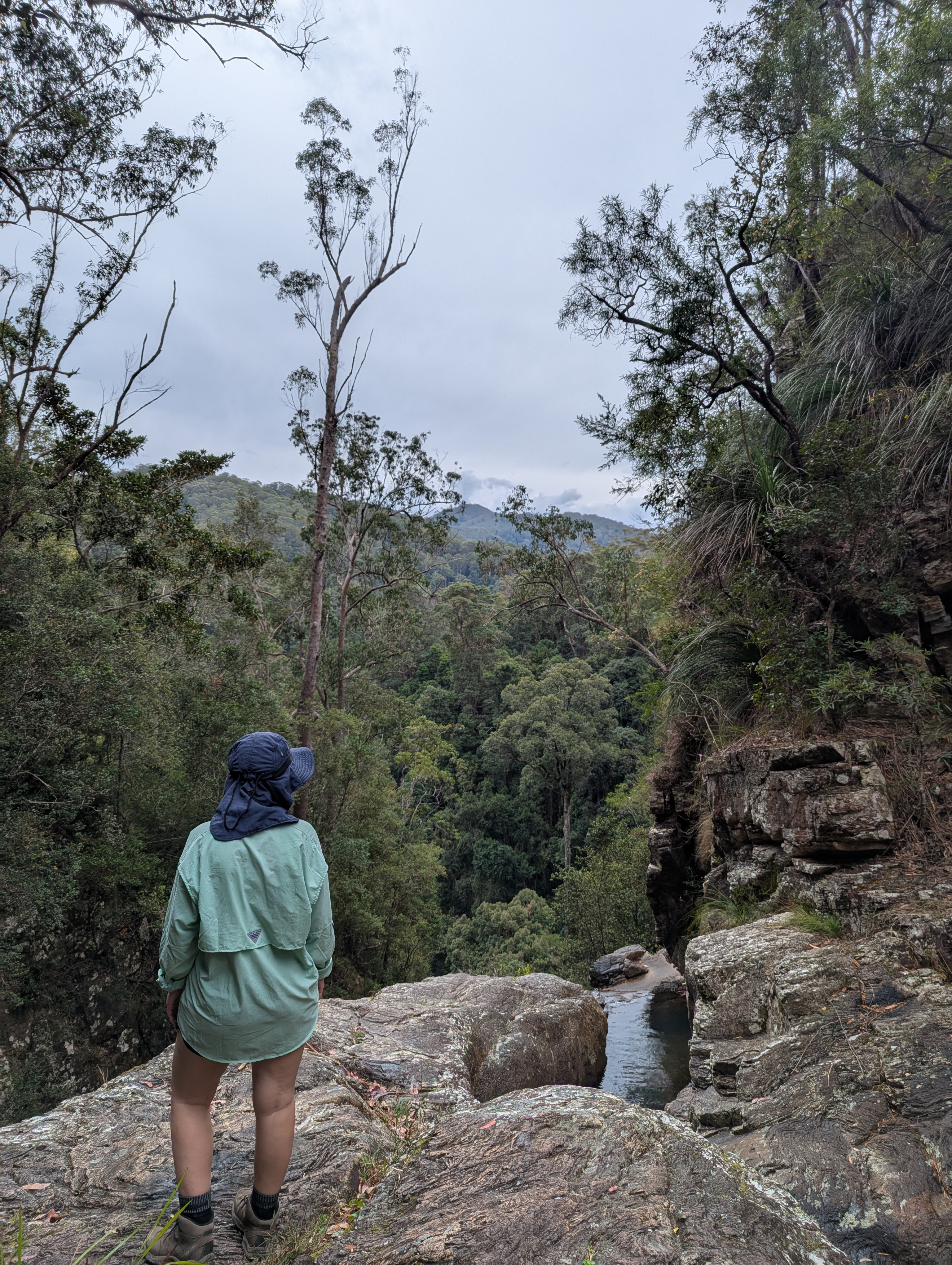
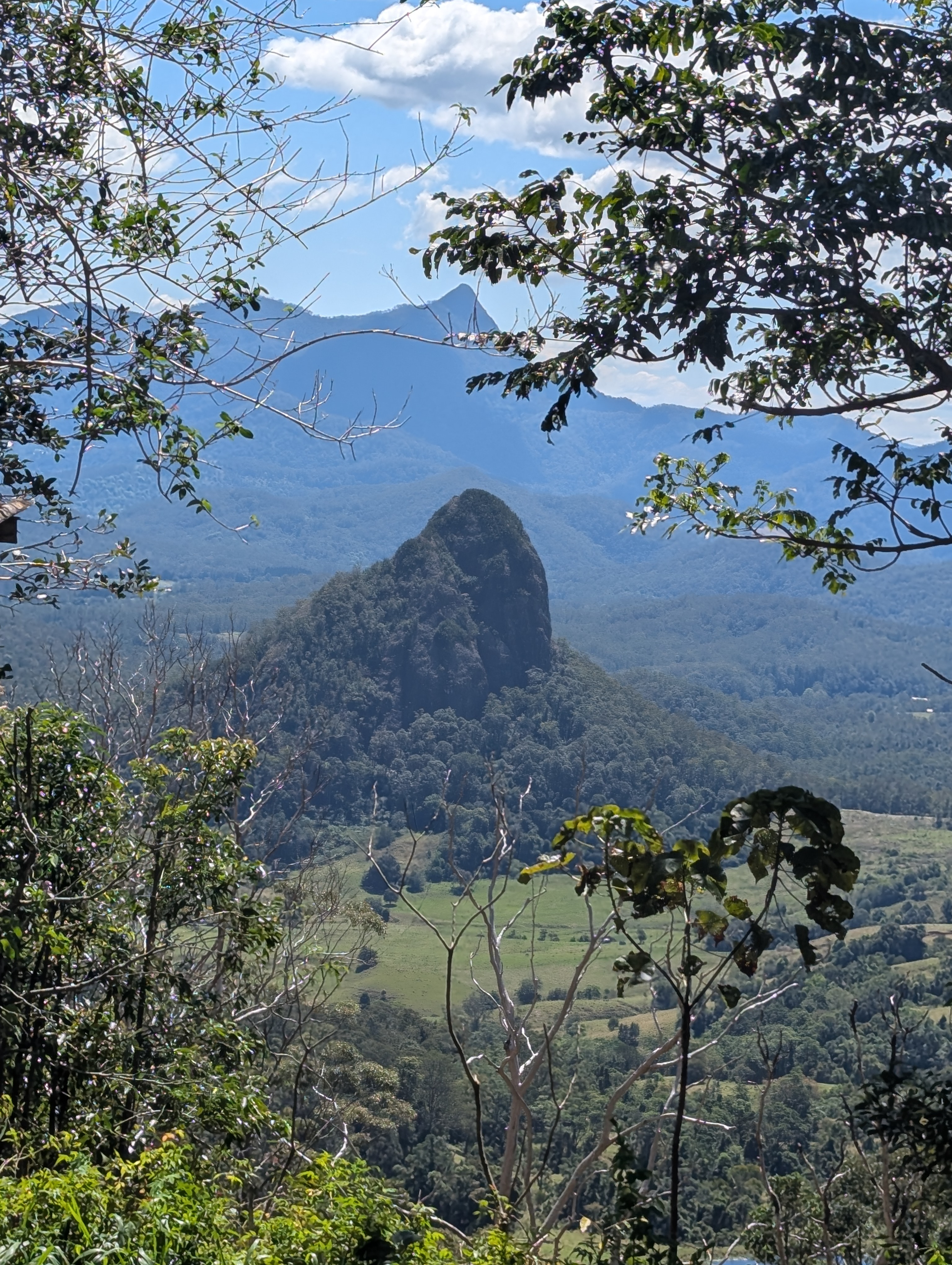
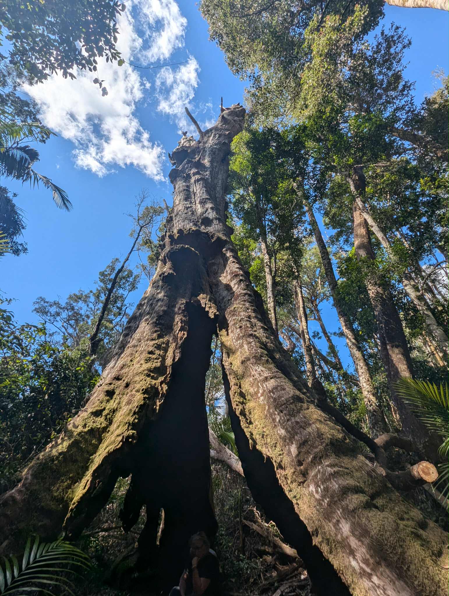
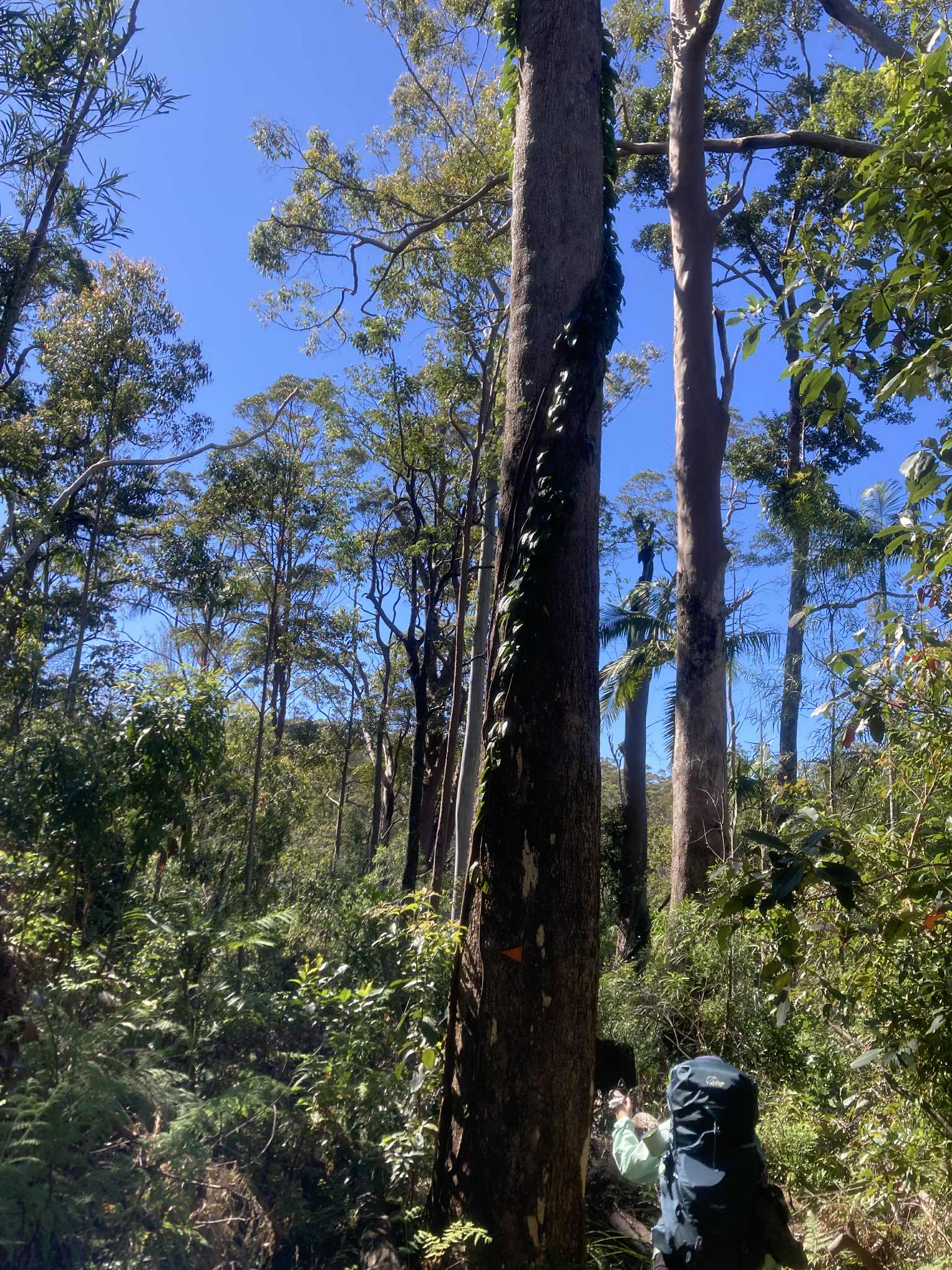
We set off around 7am and from camp the trail immediately started to climb. The first few hours of the day are a steady climb, including a long section with stairs that got the lungs pumping. Despite the difficult climb, I felt this was one of the most beautiful sections of the walk with ancient rainforest and the dangling roots of strangler figs. This section may take longer than you expect, and as you ascend the mountain, the temperature gets warmer and the trail more exposed as you transition into eucalyptus bush. We kicked into grit step mode to push through the climb, and eventually were rewarded with the first of several lookouts of the day. Grass Tree Lookout sees expansive views of Tweed Caldera and Wollumbin in the background. This is a nice photo and snack spot.
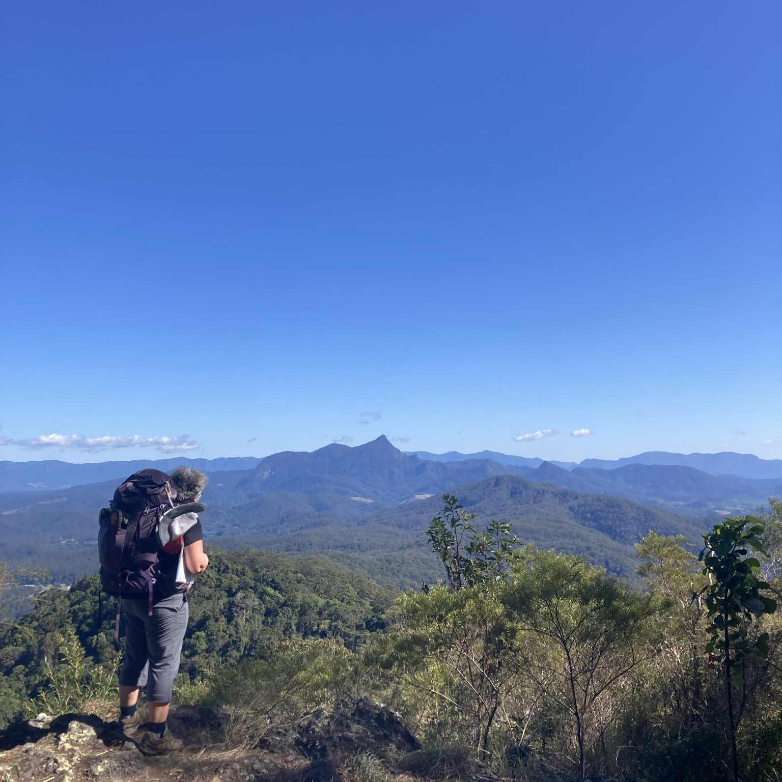
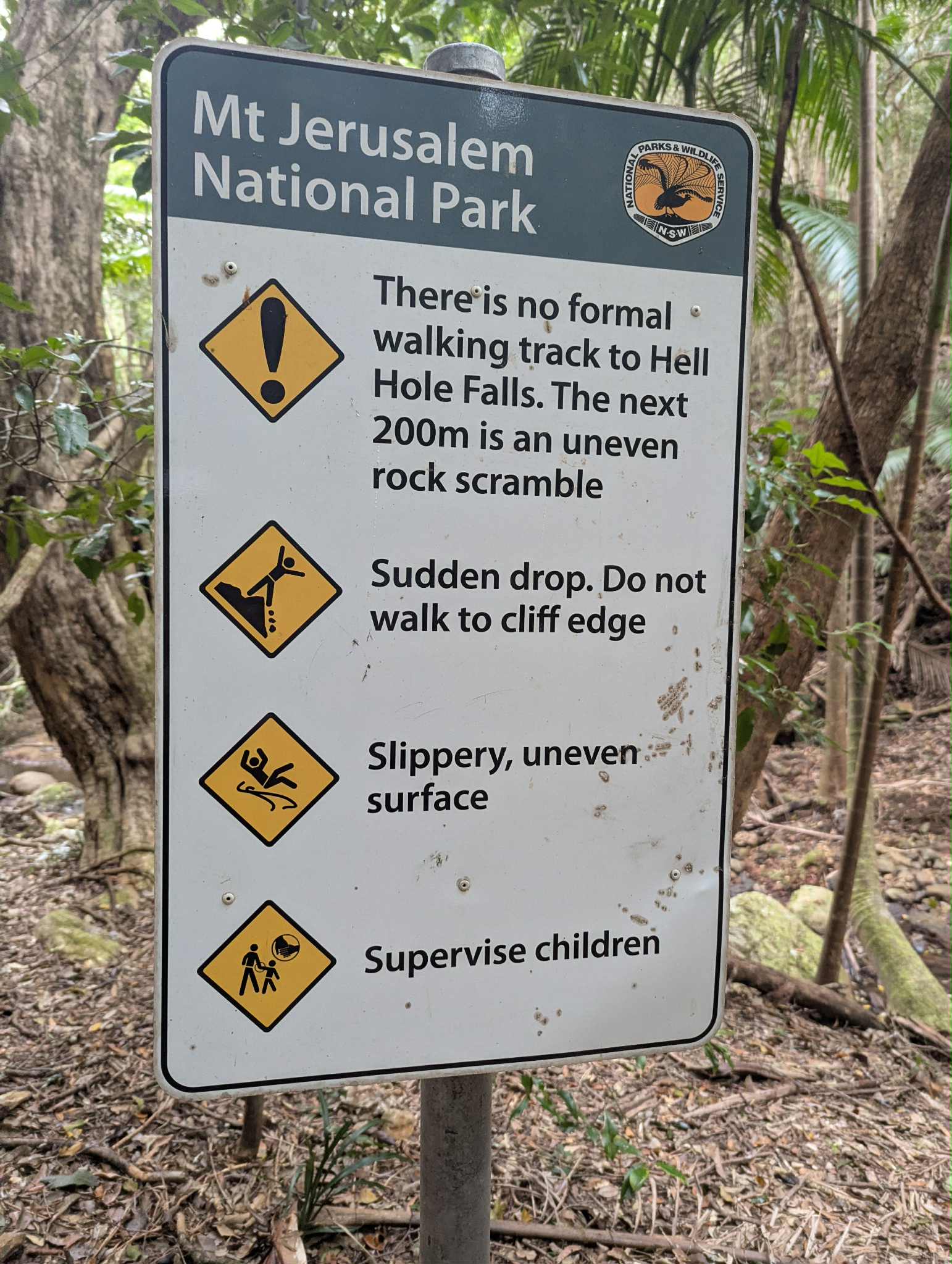
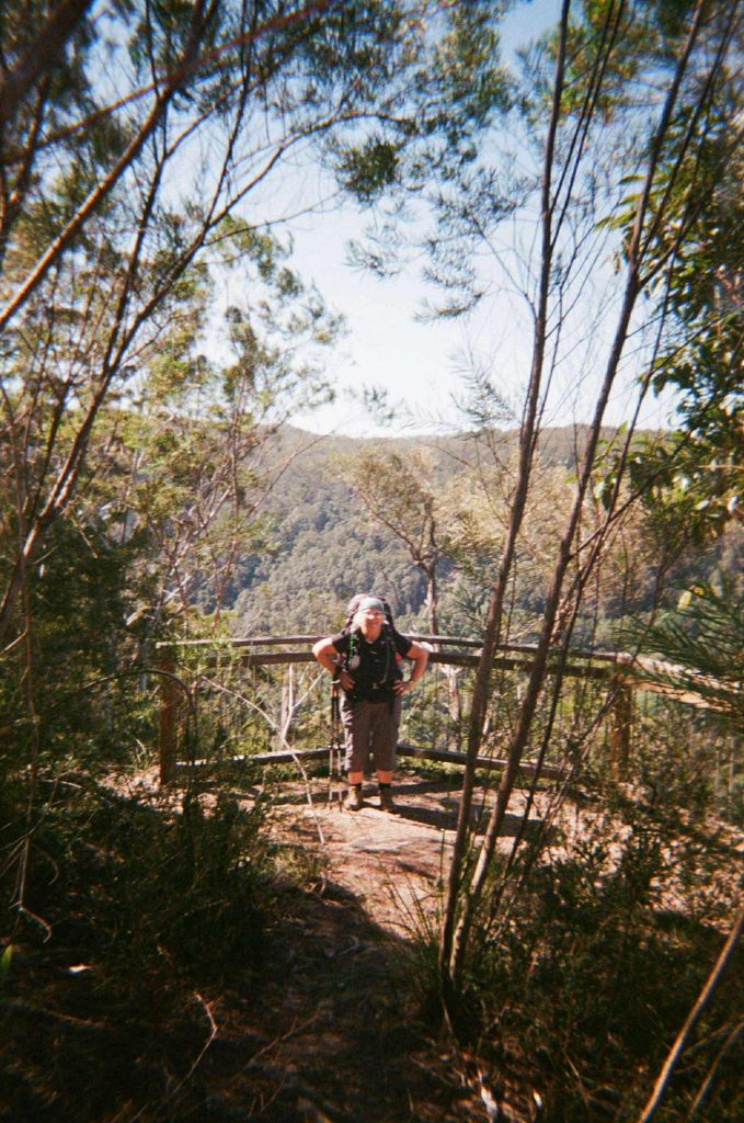
Continuing on, the path was exposed and hot, but thankfully there was some reprieve from the steep inclines. We soon came to Tweed Valley lookout, again with beautiful and expansive views. We continued onto the turn off for Jerusalem Cliffs, which involves a steep 242m (each way) side-track to the lookout. We left our packs at the bottom and walked up to the lookout where we saw views of Doon Doon and even saw some goshawks! The side-track is described as a ‘scramble’ but it is not too difficult of a scramble (at least in dry conditions). However, if you are afraid of heights like I am, take a friend to hold your hand. This section of the track was very dry dirt, with evidence that it was recently very sticky mud. If you go after rain, this may be a very muddy and uneven section of the trail. Here we had one of our group topple over on the uneven earth!
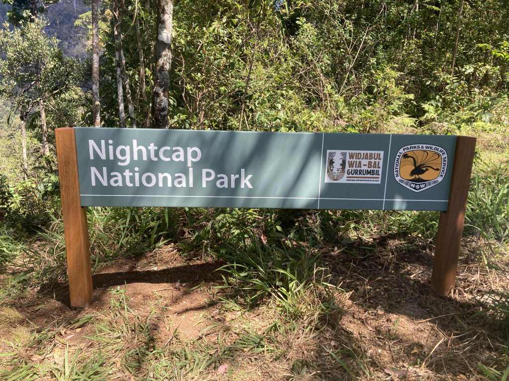
The trail has some up and down sections before arriving at Doon Doon saddle. Here we exited Mount Jerusalem National Park and passed through some private property before entering Nightcap National park. It is clearly signed that you are entering private property, but after this we lost track of any markers. There is really only one option which is to follow the road, so it was fine, but had us momentarily concerned we’d gotten off track. The saddle has incredible views but we did not stop as this was part of the private property.
On the other side of the saddle the temperature seemed to drop as we entered rainforest again. I’m not sure if we got confused with all of the lookouts, but we seemed to somehow miss Byron View lookout which was our planned lunch spot. We tried to push through until we found the lookout, but were too hungry and fatigued so just stopped for lunch on the trail at what we hoped was about the three-quarters mark. It was at this point mum realised she was almost out of water and we started to think more carefully around our water intake and sharing what we had left. This seemed to be a consistent issue with other walking groups also getting low on water at this point in the day.
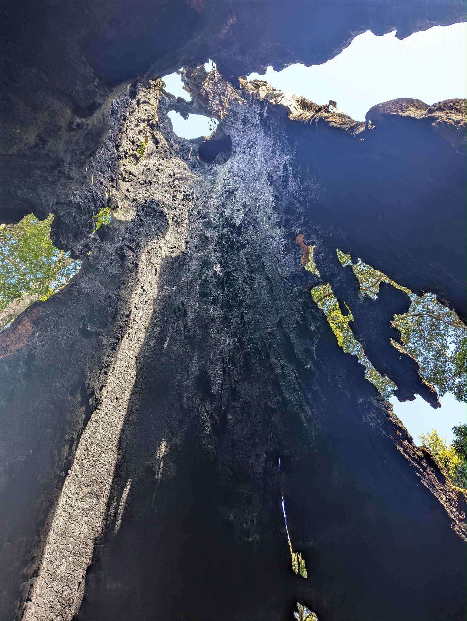
After a refuel, we commenced the final climb to Doughboy Mountain View lookout. Shortly afterwards we came to Tea Tree lookout. The next landmark was Postman’s Tree, a huge burnt-out New England Blackbutt which previously gave shelter for postmen travelling through the area. We knew to expect to see the tree, so we kept looking at all the biggest trees wondering if it was the one, but trust me, you’ll know when you find it. Postman’s Tree was the highlight of the day for me. We sat inside the tree, breathed in its smokiness and looked upwards to the sky peeking through the top of the old tree. From here it was an easy finish and a more relaxed descent to Yelgun Kyoomgun campground. We lay out in the remaining sun for a snooze, before cooking up Mex beans and mash potato for dinner.
Yelgun Kyoomgun Campground:
Meaning ‘sun and stars’, Yelgun Kyoomgun sits high-up on the hillside overlooking bush below (and even some big city lights of Lismore in the distance). This is a perfect campground for star-gazing and observing nocturnal creatures in their home. This area is apparently rare for it’s unique combination of high altitude eucalypt forest, creating the ideal environment for native mint and Lepidosperma clipeicola (NSW Government, 2025). This was also the campground where a few people had issues with rats getting into their tents. It was about 4:30am on day three when we heard a scream, followed by the banging of pots/pans and the loud and incredulous whisper of “there’s two of them??”. It was later confirmed that rats (or bush mice? – not sure) got into the tent looking for food, and had also made their way into another couple’s tent. In both cases, the rats/mice ate their way through the pack hip pocket to get to remnants of food in the pockets. They ate through not only the canvas, but the zipper rendering the hip pocket unusable. Read campsites section for more information on how we dealt with the mice/rats.
Peaks & Pits:
PEAK: Postman’s Tree
PIT: Tough morning climb, running out of water
Day 3: Yelgun Kyoomgun Campground to Weeun Weeun Campground
Distance: 11.5km
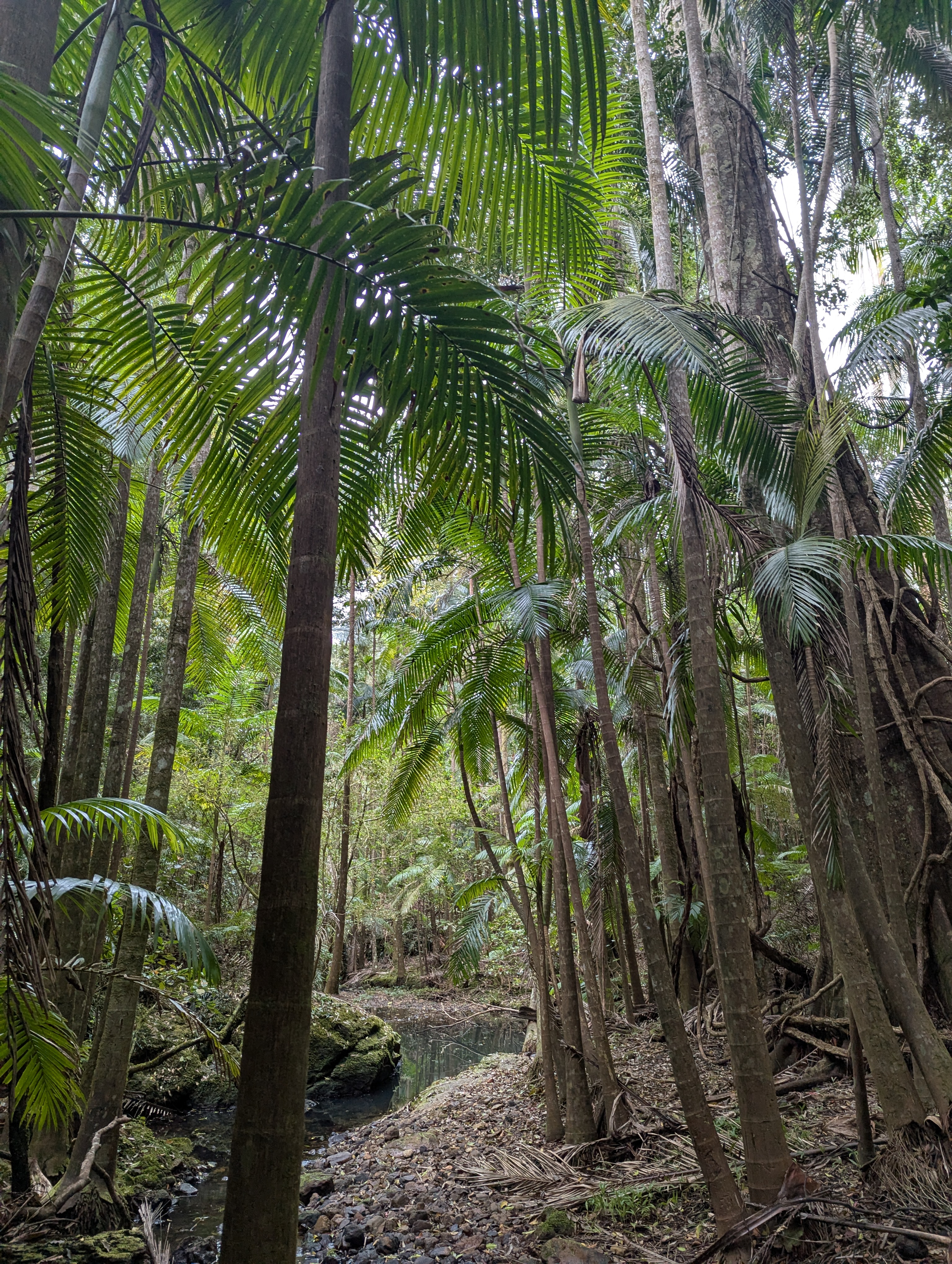
Day three starts with a calming descent. After not too long, the trail leads off-road and enters bushy eucalypt forest which felt very snakey (although we didn’t see any along this section). With so many eucalyptus trees around, we were constantly vigilant for koalas but no luck. The path then shifts to beautiful green and cool rainforest, with new birdsong emerging and sections with short board walks. Again, it was very hot when we walked but I can imagine this would be very leachy after wet weather.
Maybe because we’d been so mentally prepared for the day before, but we all found day three harder than expected. The walking itself was quite relaxed, but the hours started to drag by the end of the day. However, a few star moments kept our energy up and spirits alive. An elegant carpet python slithered directly in front of us on the path, completely unbothered by us (and almost giving mum a heart attack). We also saw a red pademelon, and my sister got a huge paralysis tick on the back of her neck.
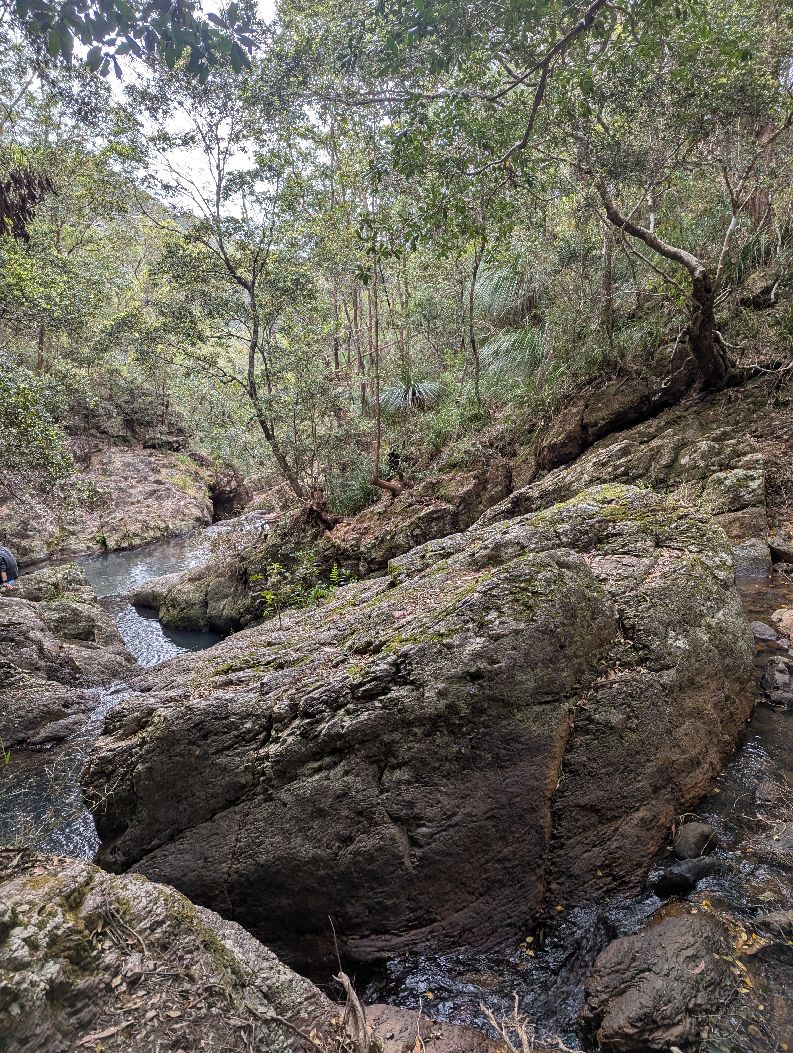
The trail eventually moved onto road and we passed several road and firebreak crossings. About 2km before camp, we heard the movement of water and saw a small track leading off to the side of the trail. We followed it to find a small waterhole and waterfall from the creek running above. We made the most of the water with a dip and cooling ourselves down. If you arrive early at camp and feel like walking some extra kilometers, you can always come back to the water hole later in the day for another swim as it’s not far from camp.
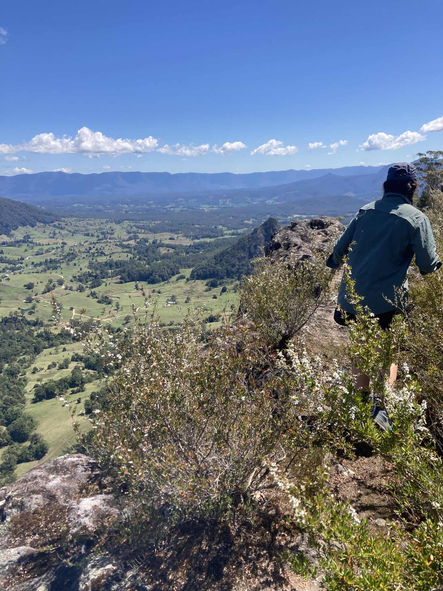
The final part of the trail before camp is up and down, however as you get closer, a tremendous view opens up on your left. At the lookout you get your first full view of the expansive cavity in the rock, filled with trees of all shapes and colours creating a patchwork of verdant greens. The view points continue as we arrived into camp, with several lookouts in quick succession.
Upon arriving at camp, we had several hours of daylight to kill which we spent playing cards, napping and enjoying the sunshine. For our final dinner, we had dhaal with rice and naan bread, washed down with a bottle of whiskey and a cup of earl grey tea. As night descended, we did some final star-gazing and went for a quick walk in hope of spotting a sugar glider to no avail.
Weeun Weeun Campground:
Meaning ‘home of the cleverman’ in the language of the Widjabul Wia-bal people, Ween Ween campground is an impressive final camp with expansive views of the Wanganui Valley. It’s a unique perspective, allowing for both the appreciation of the sheer size and volume of the valley, while also still seeing the intimate details of the rainforest and bush before you. This campsite was surrounded by birdsong and the sometimes gentle, sometimes powerful rustle of eucalypt trees in the wind.
Peaks & Pits:
PEAK: Spotting the carpet python!
PIT: Paralysis tick
Day 4: Weeun Weeun Campground to Minyon Falls
Distance: 6km
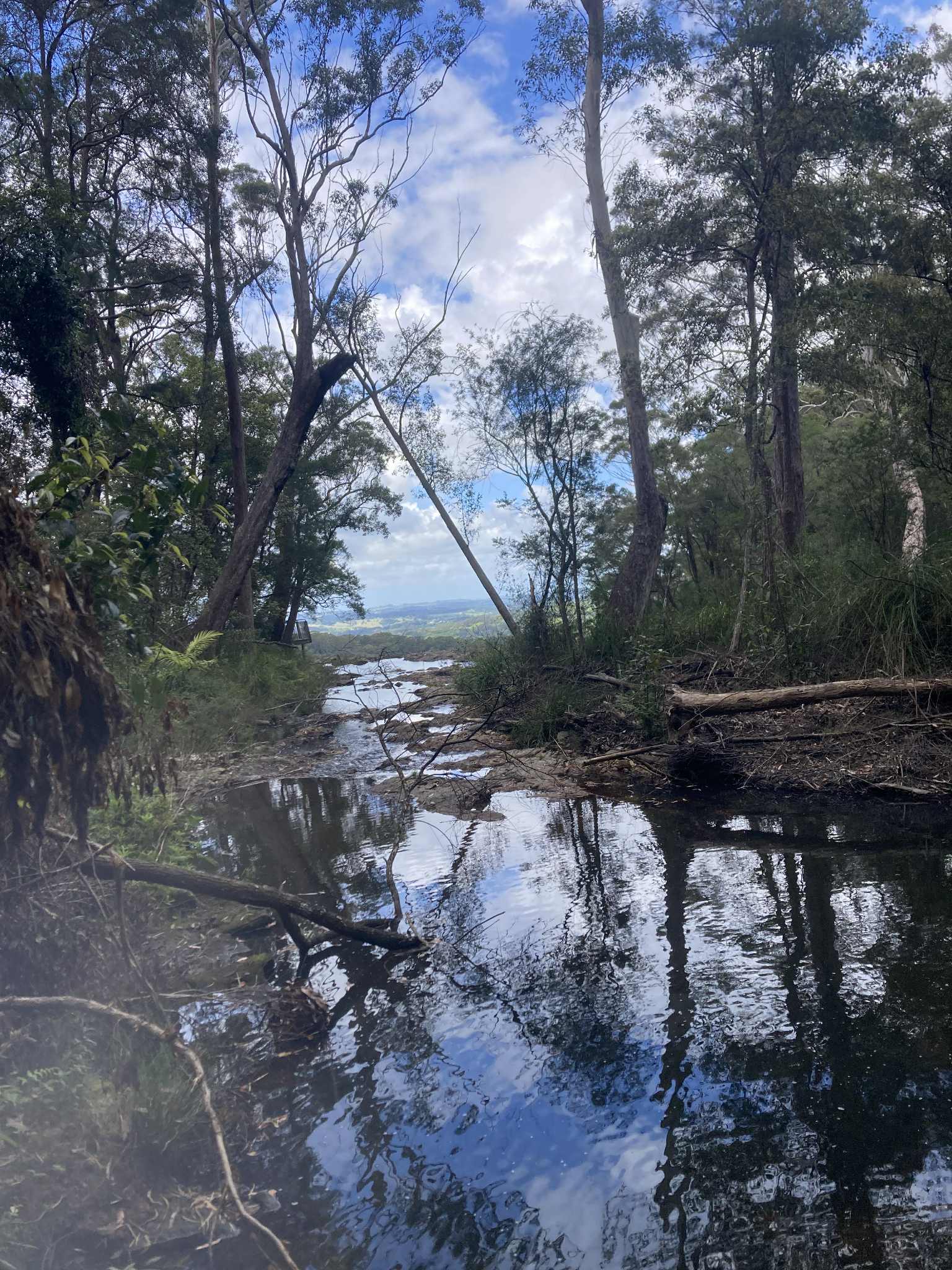
The final day commences with views overlooking Wanganui Gorge and Coopers Creek. The track starts with a descent and some creek crossings, and then turns into a climb. The path travels through subterranean rainforest before arriving at Rummery Creek. We saw several pademelons here, and also almost got lost. When you arrive into the campsite, you will need to turn left before the bridge. The creek should remain on your right-hand-side as you head towards Minyon Falls. You will follow the creek for several kilometers, walking to the sounds of babbling creek and the gentle rolling sound of small waterfalls.
We stopped at several points for snacks, and you could easily have a swim here on hot days. As you near Minyon Falls, the sounds start to change and you will eventually hear the roar of the waterfall. Once arrived, you will come to the viewing platform to look over Minyon Falls and see the tremendous drop to the bottom of the gorge. After taking in the view, we headed to a pub in Mullumbimby for a big feed and a beer before starting the drive home.
PEAKS & PITS:
PEAK: Celebratory lunch!
PIT: Getting lost at Rummery Park.
Reflections: Peaks & Pits
This trip was particularly special as it was a family affair. This was my mum’s first multi-day hike carrying her own gear and camping along the way. At 60+, this was a pretty epic example of how we can all pick up new hobbies, learn new things and take the risk of doing something you’ve never done. Even better to have done Gidjuum Gulganyi, known as Old People’s Track in traditional language of the Aboriginal custodians of the area. It’s a gentle reminder of the generations of wisdom that existed long before us and continues today, and the opportunity to learn from those around us and across generations. Credit to mum for taking on a new challenge and putting herself out there. Multi-day hiking is often a vulnerable experience, pushing us to limits and often outside of our comfort zones. This walk taught and reminded us of things about one another, and we spent a lot of time reflecting with awe on how people of this area lived on and traversed this land long before out hiking boots met the trail.
In my opinion, Gidjuum Gulganyi is a moderate walk, particular with day 2 being quite challenging. Packs we relatively light due to the short length of the walk, however our 3L water a day wasn’t enough for day 2 (on a very hot day). The terrain is not too difficult and the path is very easy to navigate, however the stairs and steep sections are tough. The pay-off is worth it for the incredible views and intimate experience of walking through Godwana rainforest. This is a good option for someone who is just starting out their multi-day hiking pursuits, and the location makes it quite accessible compared to a lot of the multi-day tracks that are remote. We did this walk in Spring, and I’m sure it would have been a very different experience after a lot of rain (I’m thinking leeches and mud), but more water would have brought the creeks and waterfalls to life even more.
We’re glad we brought:
- Tick removal equipment! We never normally take tick gear except a set of tweezers (tick removal with tweezers is advised against as it’s difficult to get the whole tick out and you risk leaving the head still in the skin). However, the day before leaving I picked up some tick removal spray. As my sister gets some allergic reactions to bites, we were glad to have the tick spray which killed the tick almost instantly. We did still have to use tweezers to remove the tick, and fortunately it came out easily enough. This was the biggest tick I have ever seen in my life (and I don’t mean because it’s swollen with blood, I mean the size of it when it was starving was at least half a fingernail). Anyway, will always be taking the tick remover in future!
- Sun protection! As we were walking in September we did not expect it to be too hot. However, it was very sunny and do not let the rainforest fool you – there are still lots of exposed sections and you will feel the full effects of the heat.
- Buffs – Mum wore a buff as a sweat band, to keep hair out of her face and it also was really helpful to keep her cool. We wet the buff in the creek to help keep temperature down which was very effective.
What we’d do differently:
- I brought an unhinged amount of rope because I was worried about tying the tent to the platform. It is super easy and we only used 2 pieces of about 1.5m string for each tent.
- If possible, have the capacity to carry at least 3.5L of water, particularly if hot weather is forecast.
- Take lots of lollies for the day 2 climb!
- Hang food and packs every night to be on the safe side.

Leave a comment